Goad Fire Insurance Maps 1904
The first surveys for the 18 numbered map sheets were done several years earlier, and were updated to 1904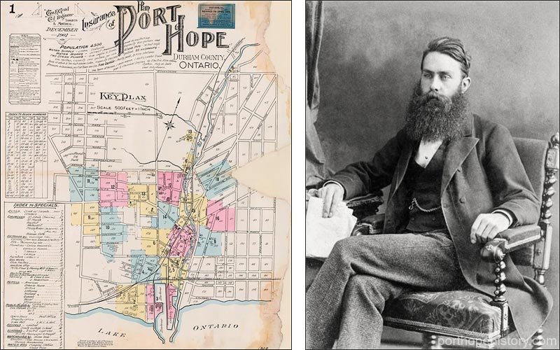
Key plan of the Goad maps, and an image of Charles E Goad from 1879 cursor over this image
click a link to view a map sheet
Goad fire insurance plans are unique primary source material capturing what is, in many cases, otherwise undocumented information about buildings, land use and urban design. Legends to interpret the many signs and symbols on the maps can be found on the 'key plan' to each volume. The Charles E. Goad map making company was established in Montreal, Quebec, in 1875. By 1885, the company was firmly established in Canada and by 1910, Goad and his surveyors had created fire insurance plans for more than 1300 Canadian communities.
from Wikipedia
Charles Edward Goad (March 15, 1848 Camberwell, Surrey, England - June 10, 1910 Toronto, Canada) was a noted cartographer and civil engineer. Goad is most noted for his insurance surveys of cities in Canada, Great Britain, and elsewhere. Fire insurance companies needed to know in detail the nature and size of buildings, width of streets, construction, building materials and the proximity of fire services and water supplies in order to estimate appropriate premiums. These and like maps are now referred to as Goad maps.
Use the form below to comment on this article. A name is required, optional email address will not be revealed.